


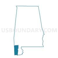
Tanner Williams Hist. Society, Mobile County, Alabama
About
Outline

Summary
| Unique Area Identifier | 522568 |
| Name | Tanner Williams Hist. Society |
| County | Mobile County |
| State | Alabama |
| Area (square miles) | 37.62 |
| Land Area (square miles) | 35.99 |
| Water Area (square miles) | 1.63 |
| % of Land Area | 95.66 |
| % of Water Area | 4.34 |
| Latitude of the Internal Point | 30.70761650 |
| Longtitude of the Internal Point | -88.37839980 |
Maps


Graphs
Select a template below for downloading or customizing gragh for Tanner Williams Hist. Society, Mobile County, Alabama


Neighbors
Neighoring Voting District (by Name) Neighboring Voting District on the Map
- Big Point Voting District, Jackson County, MS
- East Central Voting District, Jackson County, MS
- First Baptist Ch/Wilmer Off Campus Site, Mobile County, AL
- Howell School Voting District, George County, MS
- John Archer Agricultural Center, Mobile County, AL
- Semmes Community Center, Mobile County, AL
- Seven Hills Central Fire Station, Mobile County, AL
- Union Baptist Church, Mobile County, AL
Top 10 Neighboring County Subdivision (by Population) Neighboring County Subdivision on the Map
- Tanner Williams CCD, Mobile County, AL (71,460)
- Grand Bay CCD, Mobile County, AL (33,789)
- District 1, Jackson County, MS (28,313)
- Semmes CCD, Mobile County, AL (22,869)
- District 2, George County, MS (5,003)
Top 10 Neighboring Unified School District (by Population) Neighboring Unified School District on the Map
- Mobile County School District, AL (399,587)
- Jackson County School District, MS (49,652)
- George County School District, MS (22,578)
Top 10 Neighboring State Legislative District Lower Chamber (by Population) Neighboring State Legislative District Lower Chamber on the Map
- State House District 100, AL (55,488)
- State House District 102, AL (50,860)
- State House District 104, AL (47,450)
- State House District 109, MS (26,604)
Top 10 Neighboring State Legislative District Upper Chamber (by Population) Neighboring State Legislative District Upper Chamber on the Map
- State Senate District 34, AL (155,435)
- State Senate District 51, MS (62,901)
- State Senate District 43, MS (62,195)
Top 10 Neighboring 111th Congressional District (by Population) Neighboring 111th Congressional District on the Map
Top 10 Neighboring Census Tract (by Population) Neighboring Census Tract on the Map
- Census Tract 65.02, Mobile County, AL (11,958)
- Census Tract 63.01, Mobile County, AL (10,520)
- Census Tract 401.02, Jackson County, MS (7,569)
- Census Tract 62, Mobile County, AL (6,036)
- Census Tract 64.07, Mobile County, AL (6,016)
- Census Tract 9501.01, George County, MS (5,783)
Top 10 Neighboring 5-Digit ZIP Code Tabulation Area (by Population) Neighboring 5-Digit ZIP Code Tabulation Area on the Map
- 36695, AL (45,118)
- 36608, AL (36,864)
- 39452, MS (26,964)
- 36575, AL (18,345)
- 39562, MS (17,912)
- 36541, AL (15,647)
- 36587, AL (12,053)